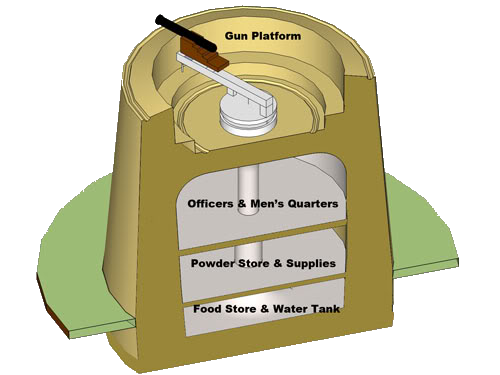
Martello Tower at Woolwich (1806 - 1810)
English Heritage “Survey of London – Volume 48 – Woolwich”, page 157 states:
The Royal Carriage Department built a saw mill in 1811-13 to the east of the carriage factory. This displaced a short-lived and mysterious Martello Tower.
Archaeological Desk-based Assessment for London Borough of Greenwich, April 2004 stated:
A Martello tower was also built at this time (Between 1806 and 1810) in the south of the Arsenal, to the north of the Storekeeper's house (Yeskell map 1810). lt had disappeared by 1813, probably because of the construction of the saw mill (PRO MPHH136).
Martello Tower at Woolwich
Ordnance Survey Map 1870 shows a Martello Tower on Plumstead marshes:
This tower is also shown on a Royal Engineers survey of 1865 where it is stated to have One Gun.
The 1904 OS map of Plumstead still shows the tower but without annotation.
The attached pdf of the 1870 OS map indicates the Martello Tower locations with Red rings.
I have not seen the “Yeskell” map of 1810 but I understand that it might appear in one of Vincent’s books.
